
Asset management is a smart practice that can save money and reduce financial surprises capable of grinding wastewater services to a halt. In order to implement asset management, systems must be able to track and assess data from many different parts of their operations and maintenance practices. For many systems, asset management data can be effectively tracked entirely through a spreadsheet or a database. For a wastewater system, however, a database-only approach to asset management can be like a puzzle with a missing piece: the viewer may be able to see the picture, but something is still missing.

IMAGE COURTESY OF D3IMAGES AT FREEPIK.COM
Geographic Information System (GIS) tools are the missing puzzle piece that can give wastewater managers a more complete picture of their system. In an earlier post, we described how GIS can store an asset database complete with all the necessary attributes for a successful data management program. Such attributes include asset type, age, condition, material, expected life, and location. The obvious added value of using GIS is the ability to view assets spatially, but how exactly does that benefit the practice of asset management?
There are 5 core components of asset management:
- Current state of the assets
- Level of service
- Asset criticality
- Life cycle costs
- Long-term funding strategy
Let’s look at how GIS can augment a database-only approach to asset management for 2 of the 5 core components: current state of the assets and asset criticality.
Current State of the Assets
An asset management plan is based on a complete asset inventory that includes a thorough attribute list for each asset. Even a small system may have hundreds or even thousands of assets, each with similar attributes. This data can be stored in a database or spreadsheet.
However, creating or uploading an asset inventory to GIS allows assets to be viewed through an interactive map. Wastewater managers can see the data spatially, which provides a new perspective on the collection system as a whole. Numerous questions become easier to answer by viewing assets spatially, such as:
- Are there obvious missing assets, such as a missing pipe run that should connect 2 points?
- Are there connections to the system from outside the service area?
- Do the assets cover the entire service area?
- Do I know my system boundaries?
- How can I develop or improve maintenance scheduling?
Asset inventories can include any type of wastewater system component, but GIS is especially helpful for collection systems with many diverse components scattered throughout a large area. Developing a spatial inventory (pictured below) of manholes, valves, pipes, pumps, and other items helps managers track where assets lie and fill in gaps, as well as facilitating improved inspections with visual assessment.
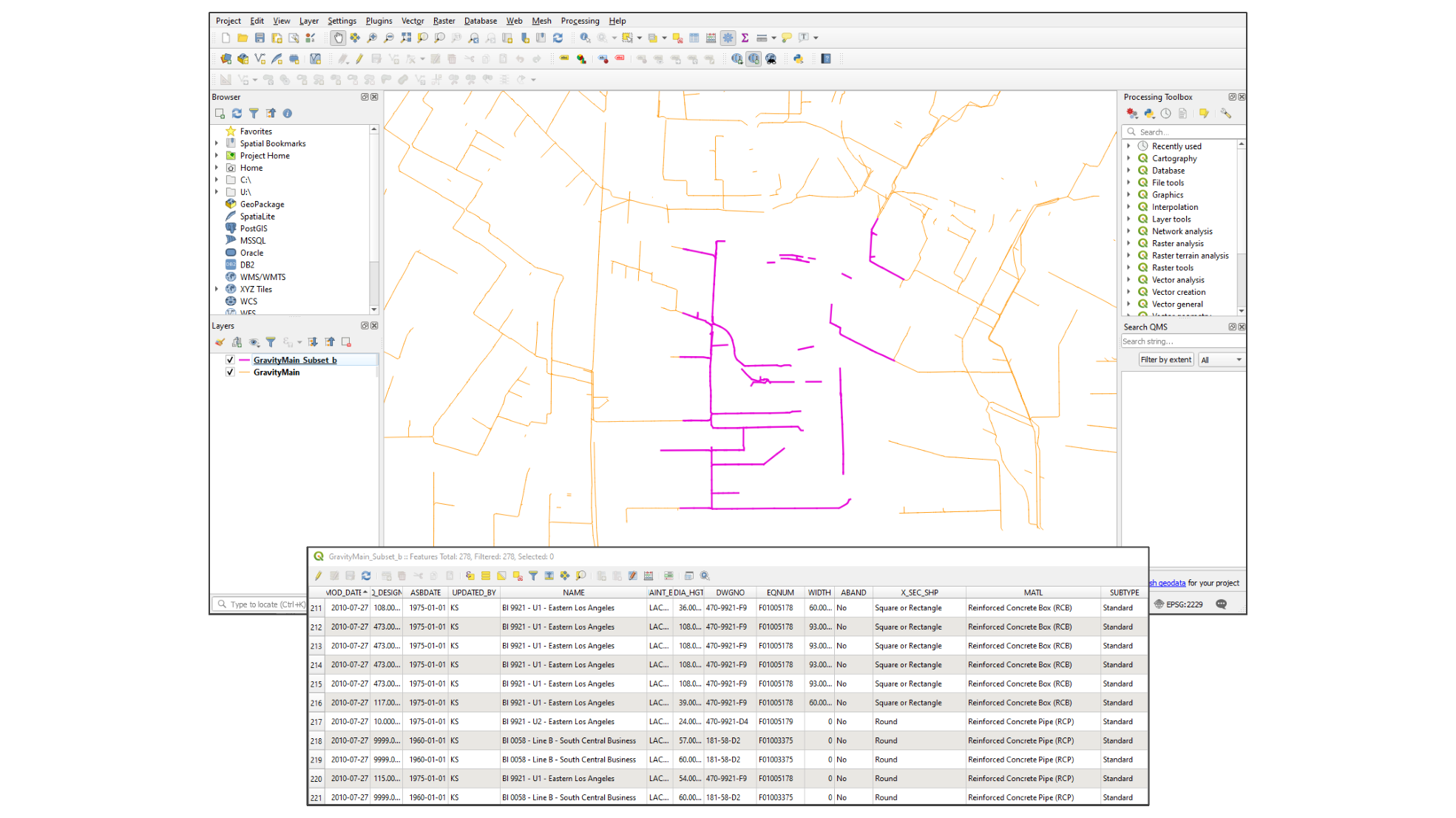
A GIS ATTRIBUTE TABLE SHOWING AN INVENTORY OF WASTEWATER SYSTEM ASSETS, CREATED THROUGH QGIS. THE ASSETS ARE HIGHLIGHTED ON THE MAP (IN PURPLE).
Asset Criticality
Asset Criticality is a measure of the likelihood and consequences of failure. Within an asset inventory, an asset risk evaluation can help rank assets based on their criticality to prioritize maintenance, repair, rehabilitation and replacement. GIS helps with the asset risk evaluation and prioritization by answering:
- Does the asset have redundancy?
- What other infrastructure is located near the asset that would be affected by the failure?
- Is there a portion of the collection system that would be out of service if the asset failed?
- Are any assets unknowingly located close to environmental hazards, such as high flood-risk zones or a fault line?
When viewing collection assets in a database and thinking about asset risk, it can be easy to see only asset attributes such as age. However, when viewing a map of assets, it is easier to realize that two seemingly identical pipes in the database may have very different relationships to the environment. One pipe may be under a little-trafficked country road, while the other may run under a main street downtown. One may service a new housing community that is still under construction, and the other may service a large hospital. The ability to see assets’ relationships with their environments makes risk assessment easier.
Getting started in asset management and using GIS tools may seem overwhelming, but there is guidance for choosing a GIS application and for implementing asset management. For more personalized instruction on asset management, the Environmental Finance Center Network frequently hosts online and in-person training. The EFCN also provides FREE technical assistance for asset management, GIS, and a slew of other technical, managerial, and financial wastewater system needs. You can request assistance here.